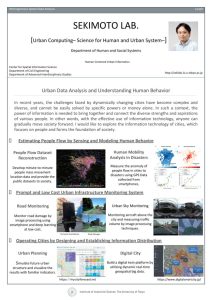
研究活動Research
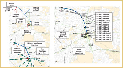
人々の流動を計測し行動モデルと組合せて推定する。
Estimating People Flow in Combination of Sensing and Behavior Modeling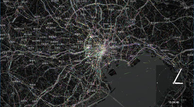
様々なコンテクストにおける人々の移動をデータから解明する。
Unravelling People Movement in Specific Contexts
都市インフラを低廉・迅速にモニタリングする
Monitoring Urban Infrastructure Rapidly and Cheaply
国や地域の情報流通を設計・構築し、都市を駆動する
Operating Cities by Designing and Establishing Information Distribution
キャンパス公開2025 – 研究ポスター
代表的な研究のポスターを一覧で表示しています。これら以外にも、さまざま研究を行っています。詳細については、【研究活動】から移動できるテーマ別の研究紹介ページをご覧ください。
各ポスターの内容は、画像をクリックすることで閲覧可能です。
関本研究室研究紹介 / Sekimoto Lab Research Introduction
REO: Regional Economics Optimization
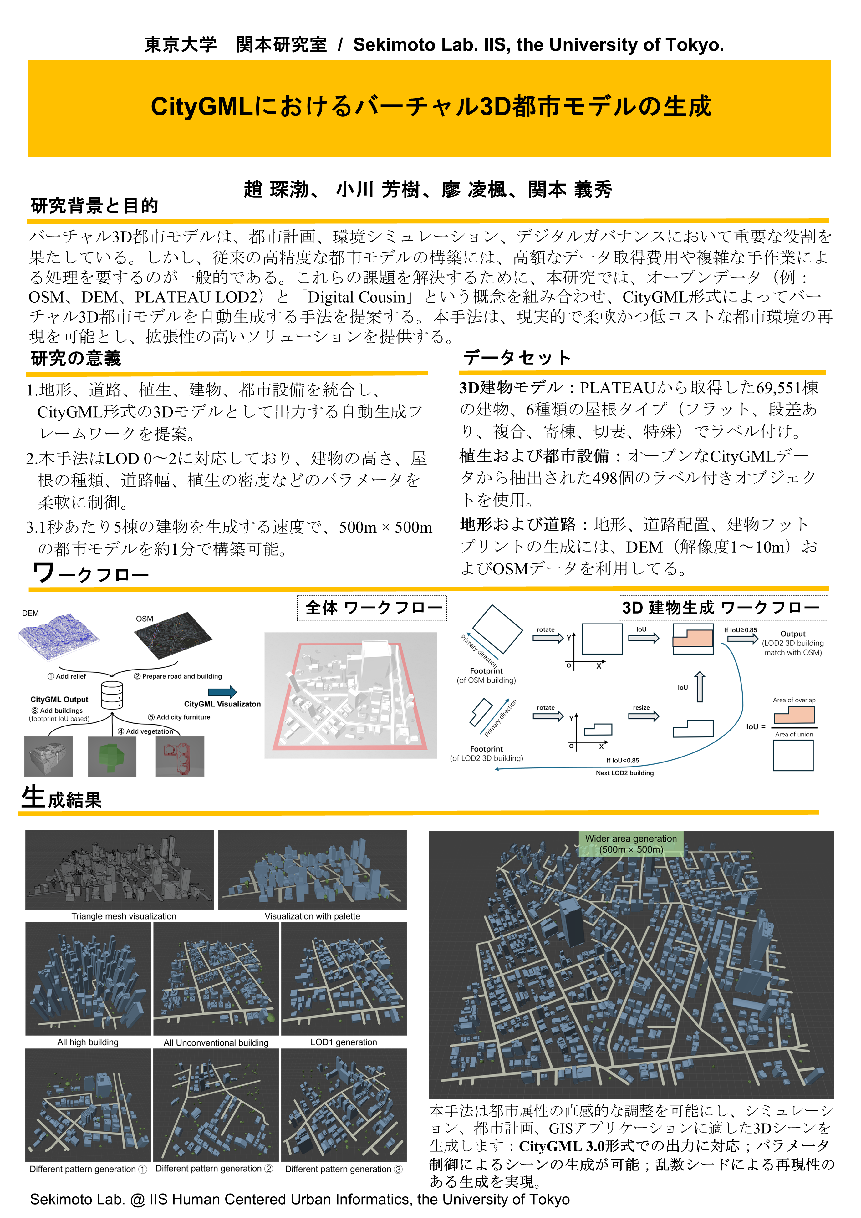
1: Virtual 3D City Model Generation in CityGML
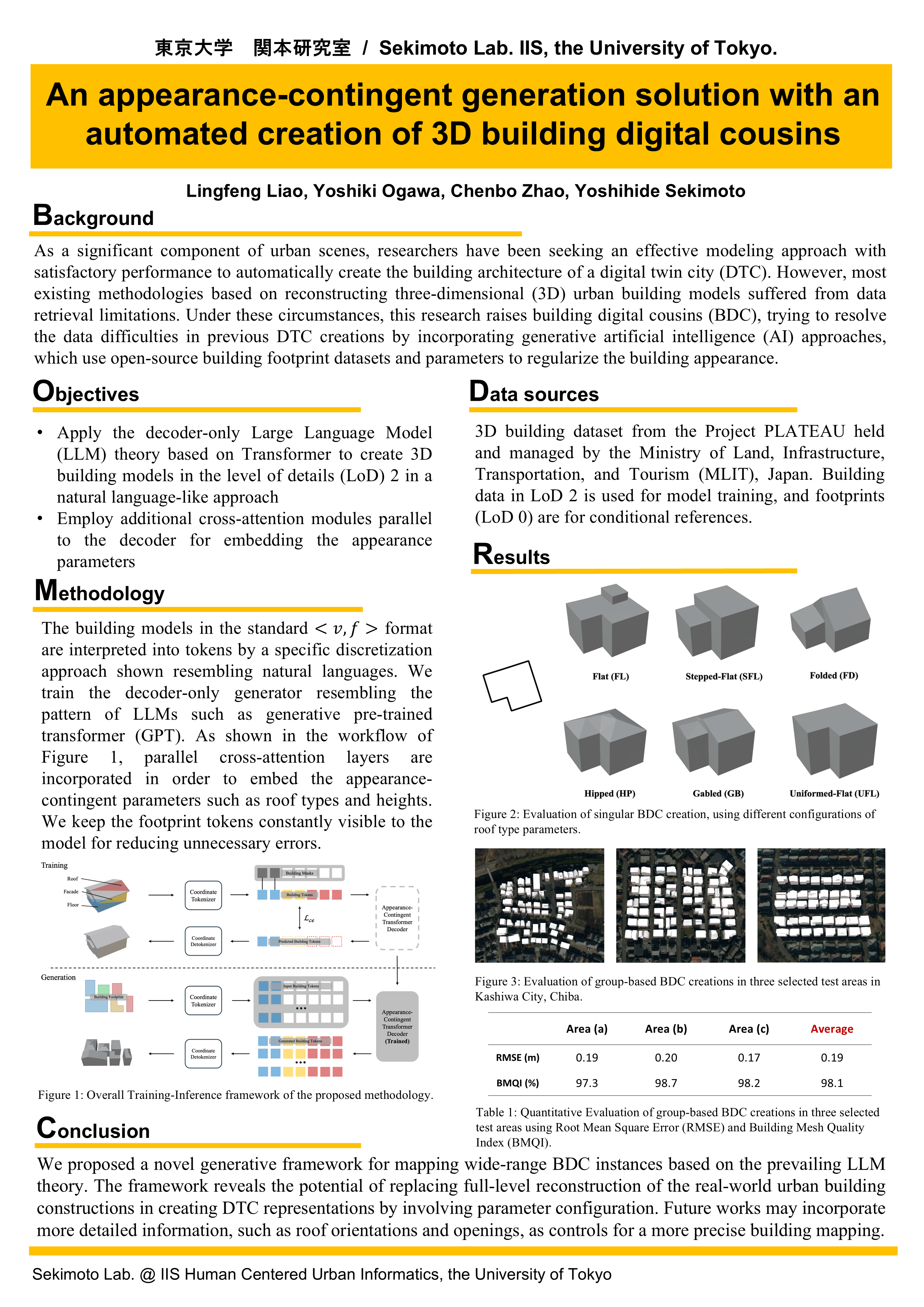
2: An appearance-contingent generation solution with an automated creation of 3D building digital cousins
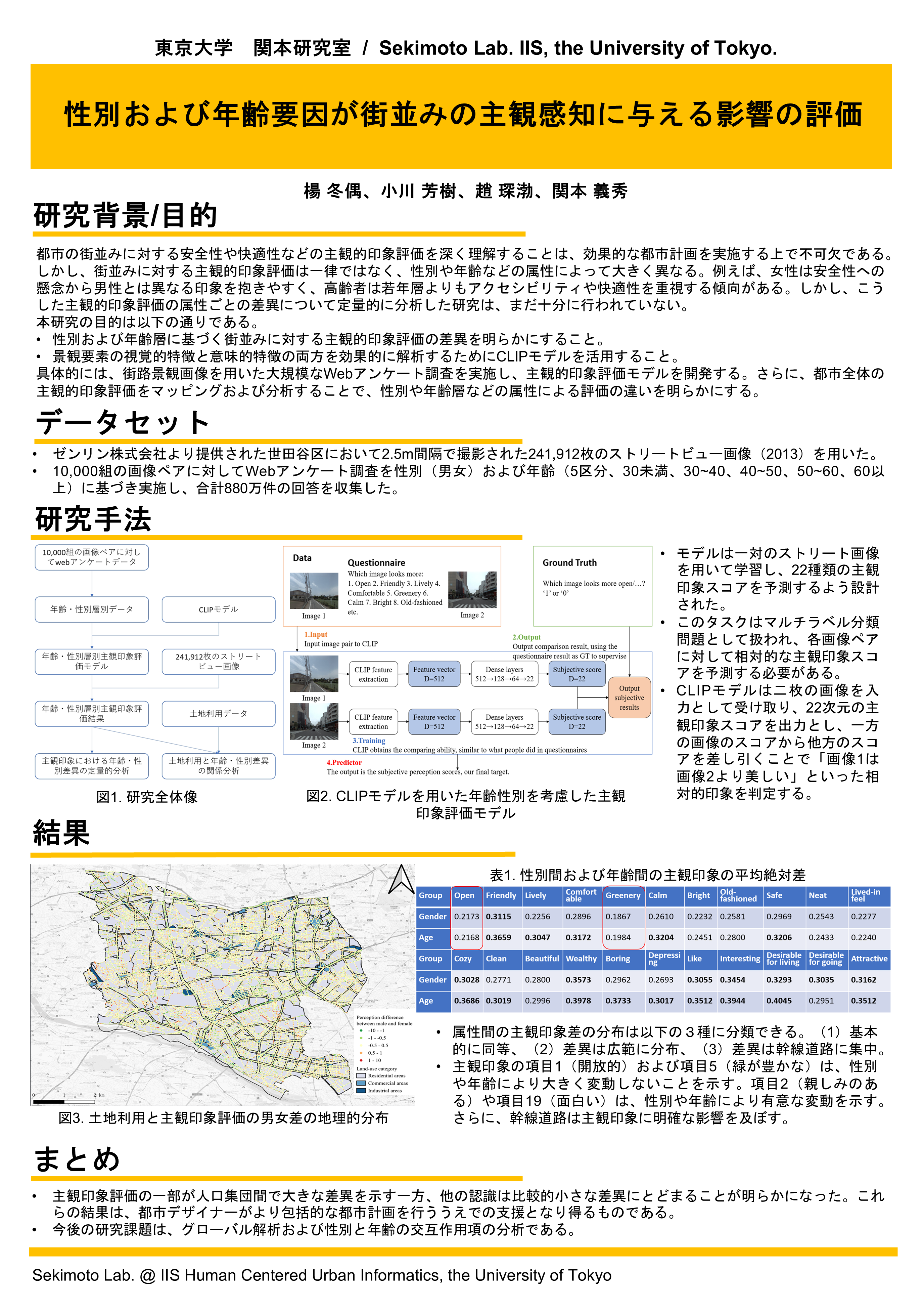
3: Evaluating the Influence of Gender and Age Factors on Subjective Perceptions of Streetscapes
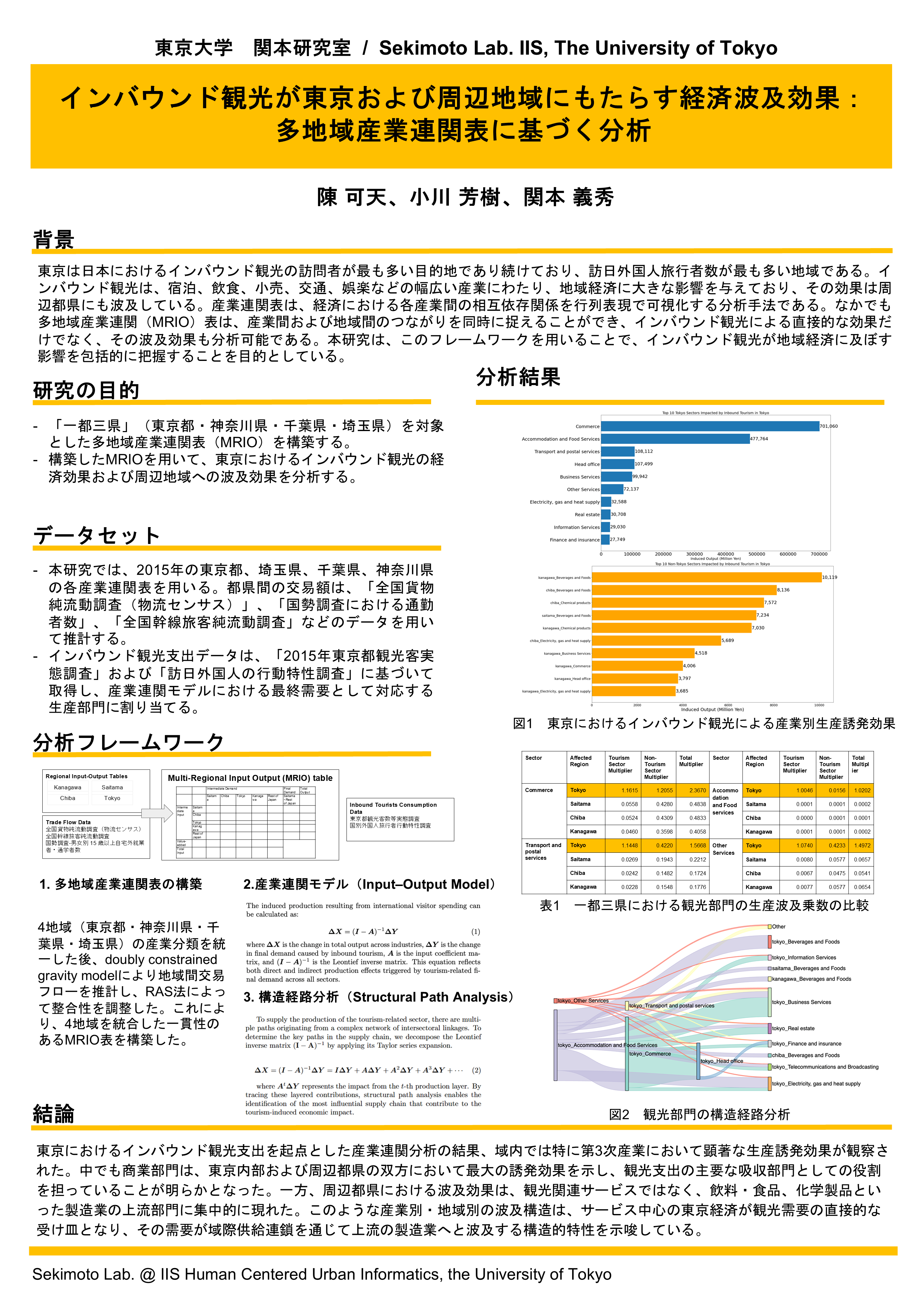
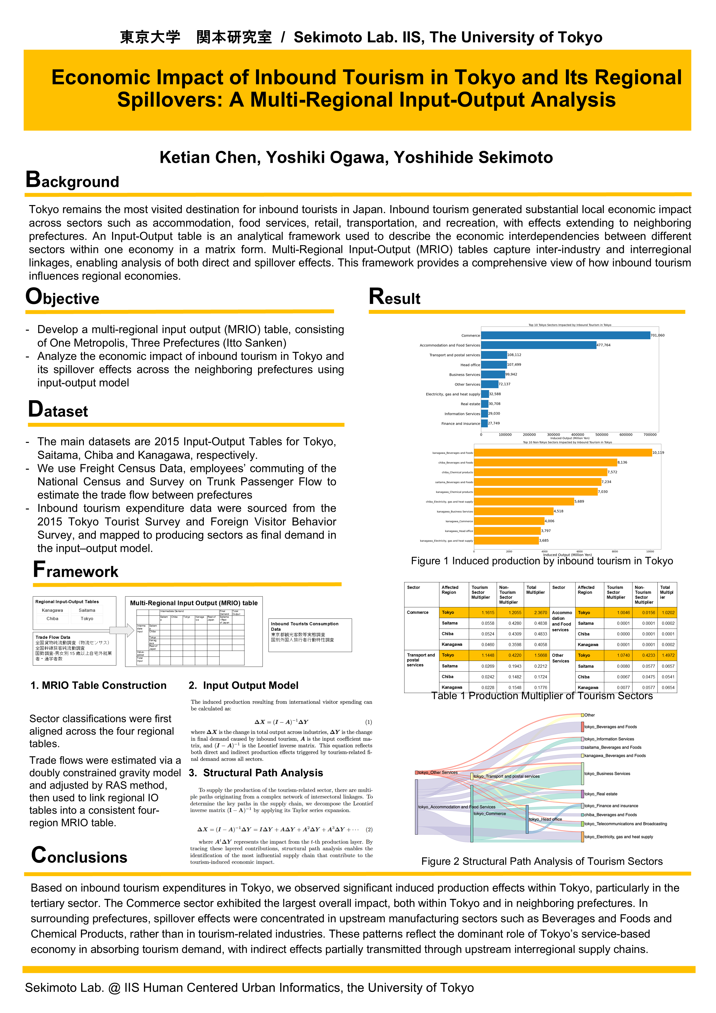
4: Economic Impact of Inbound Tourism in Tokyo and Its Regional Spillovers: A Multi-Regional Input-Output Analysis
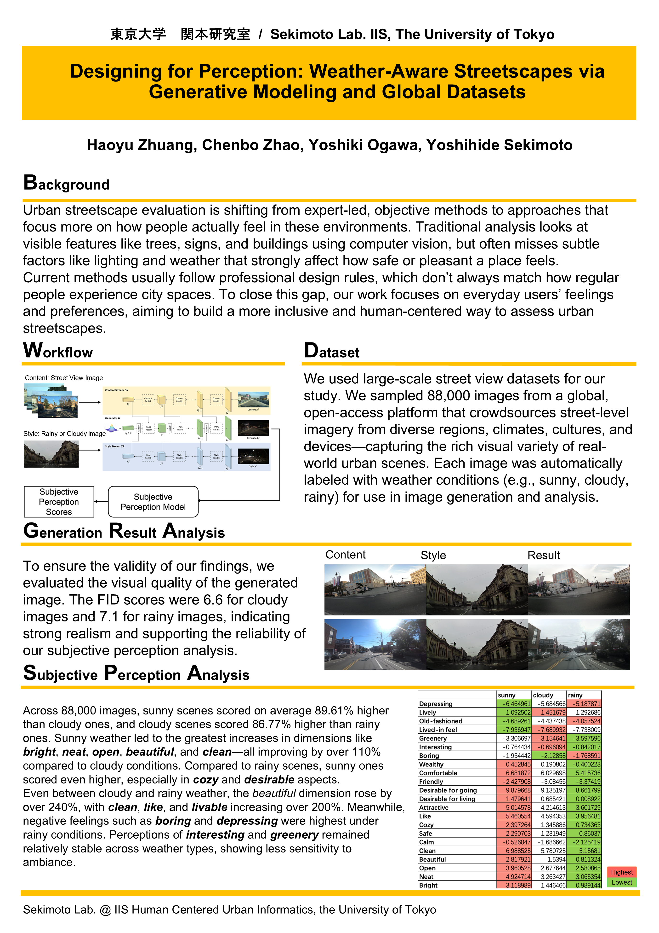
5: Designing for Perception: Weather-Aware Streetscapes via Generative Modeling and Global Datasets

HMS: Human Mobility Simulation
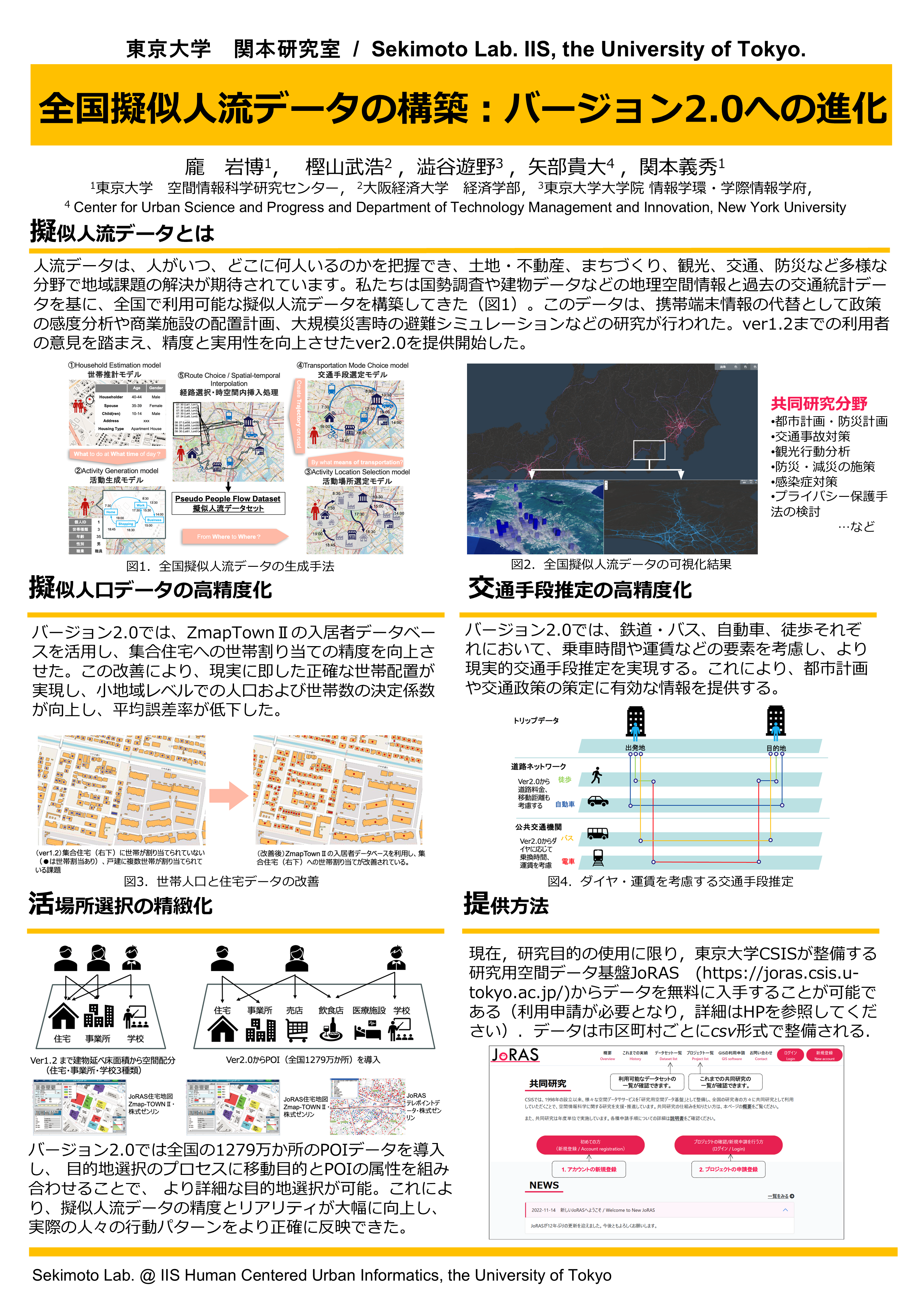
1: Construction of National Pseudo Human Flow Data: Evolution to Version 2.0
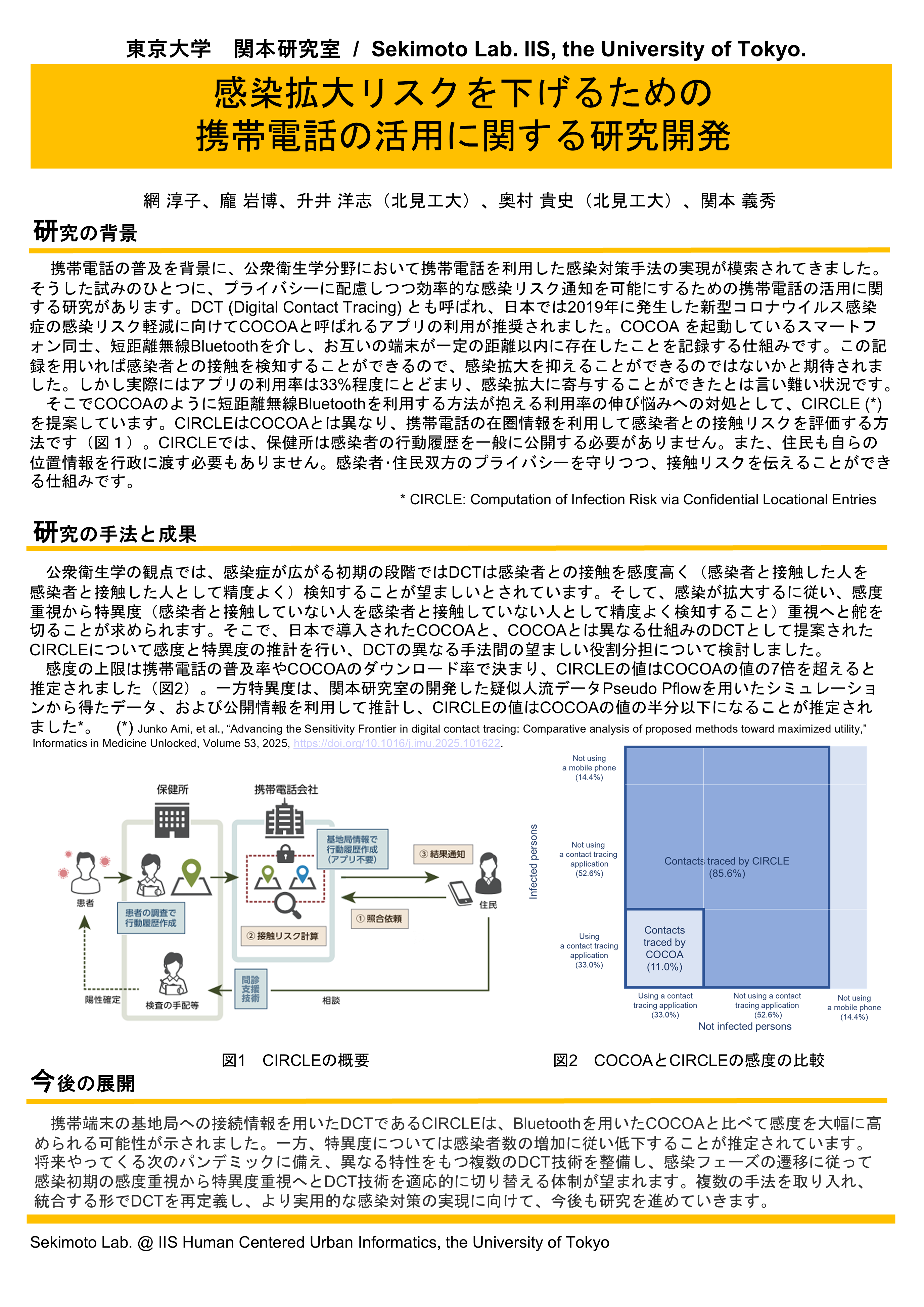
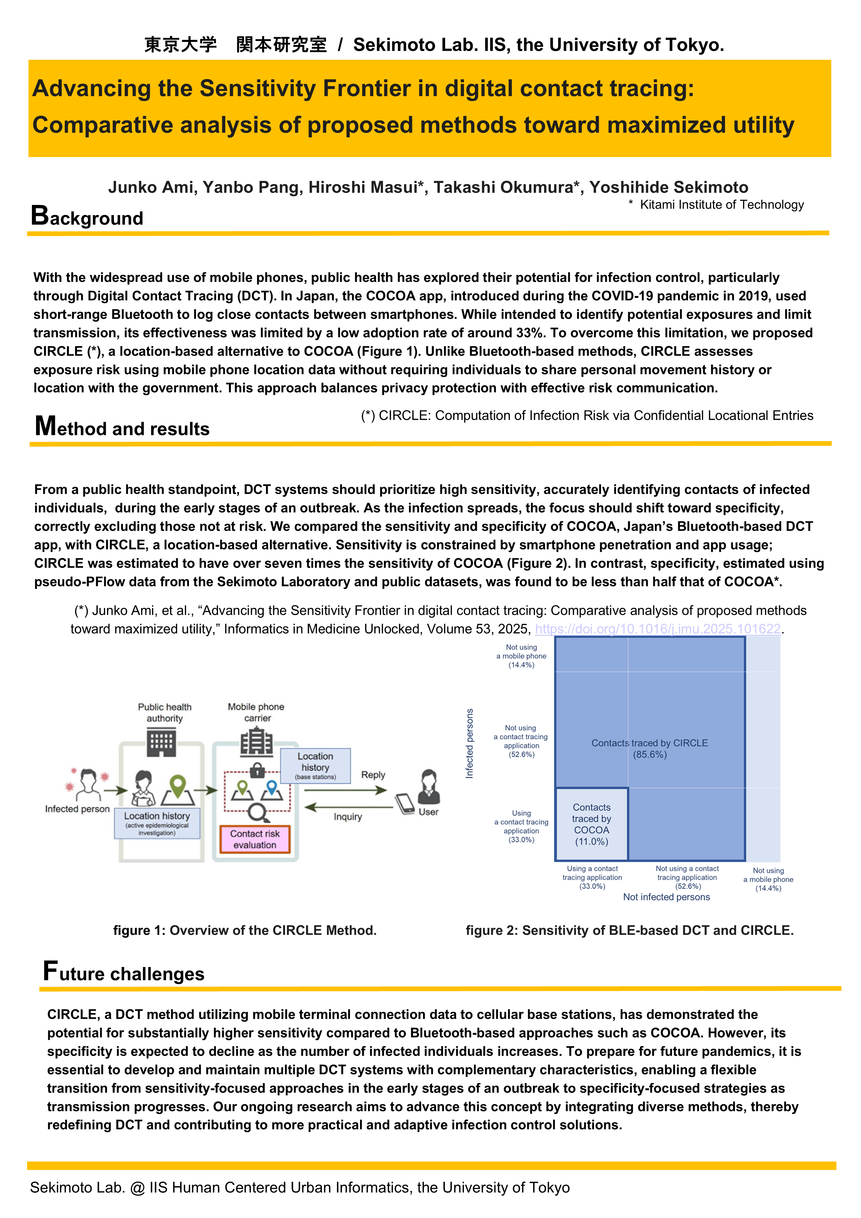
2: Advancing the Sensitivity Frontier in digital contact tracing: Comparative analysis of proposed methods toward maximized utility
3: Detecting Human Flow Surges to Identify Event-Driven Activation in a Small City
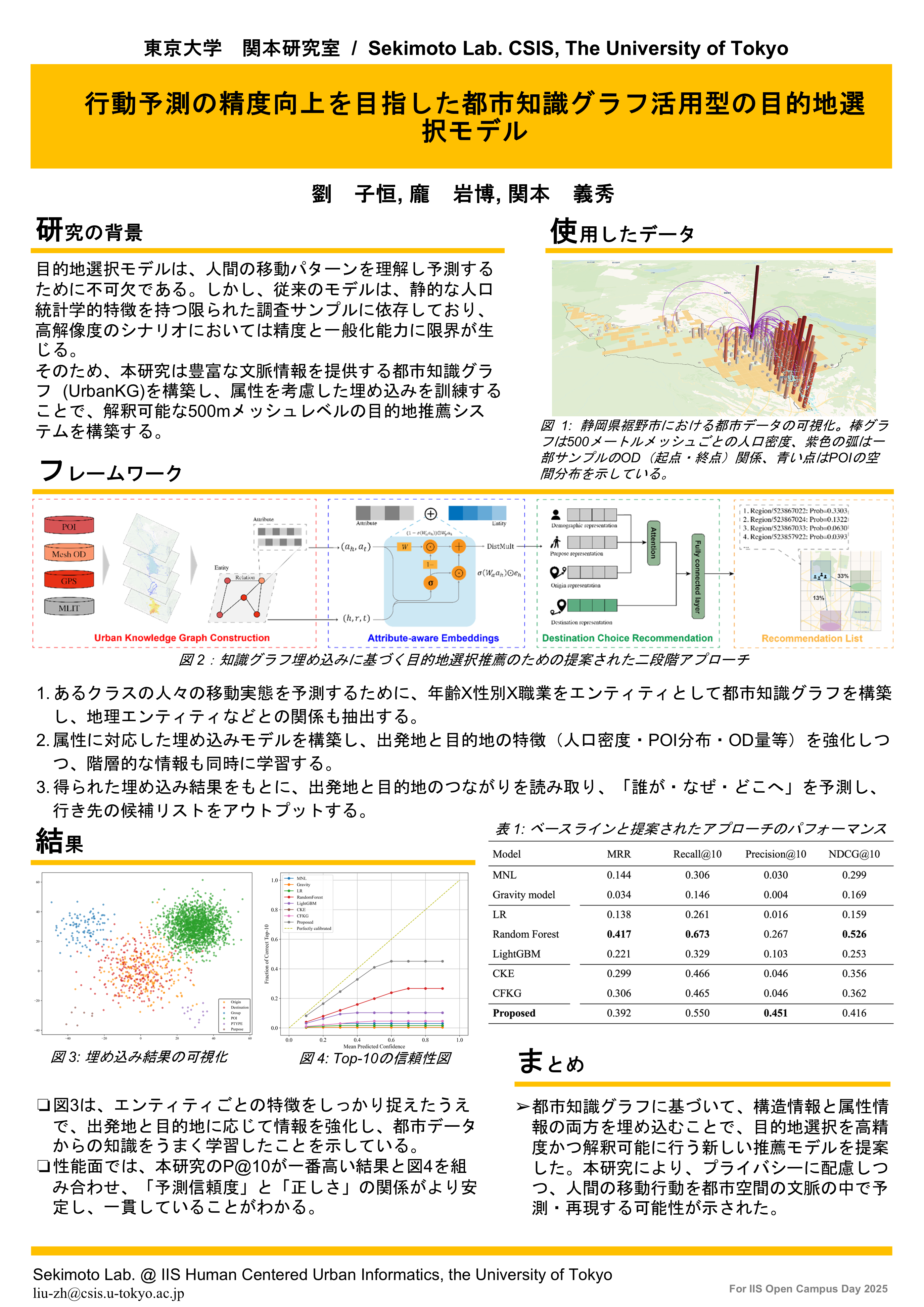
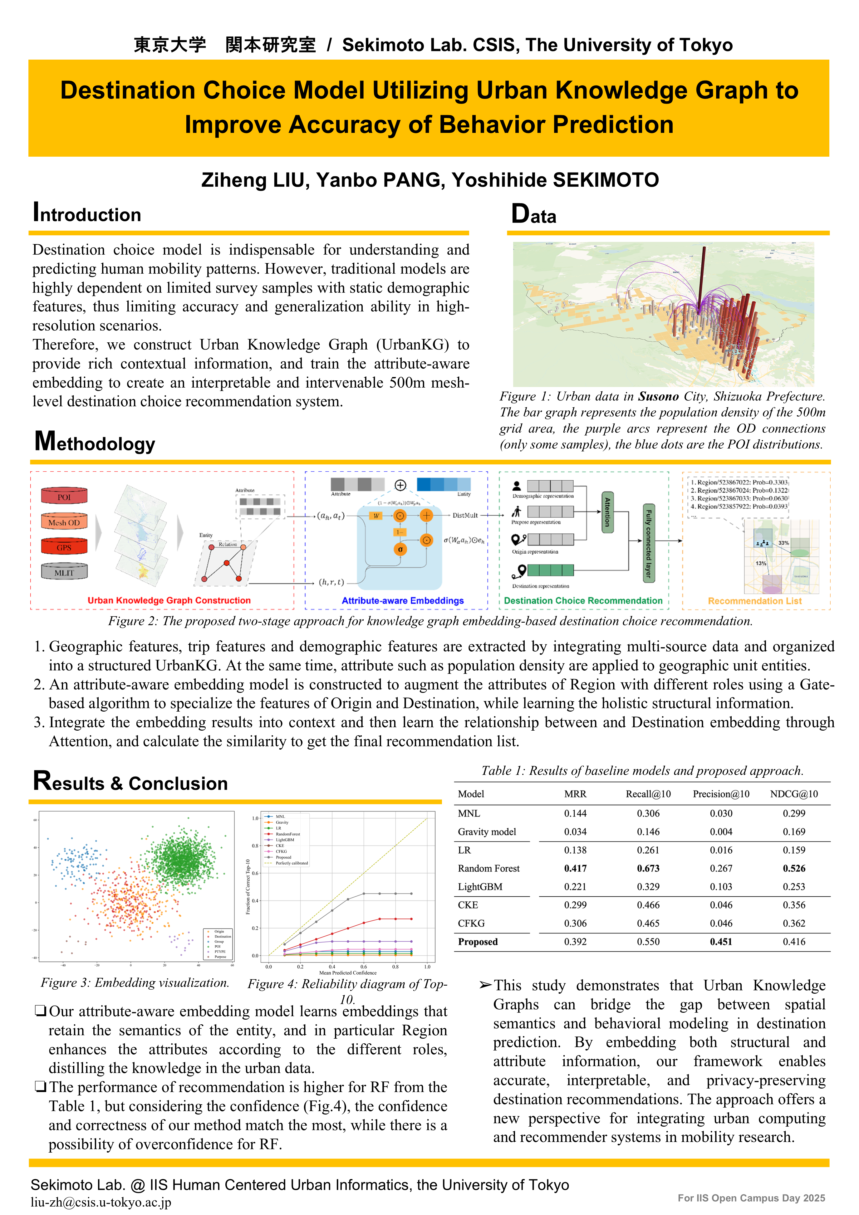
4: Destination Choice Model Utilizing Urban Knowledge Graph to Improve Accuracy of Behavior Prediction
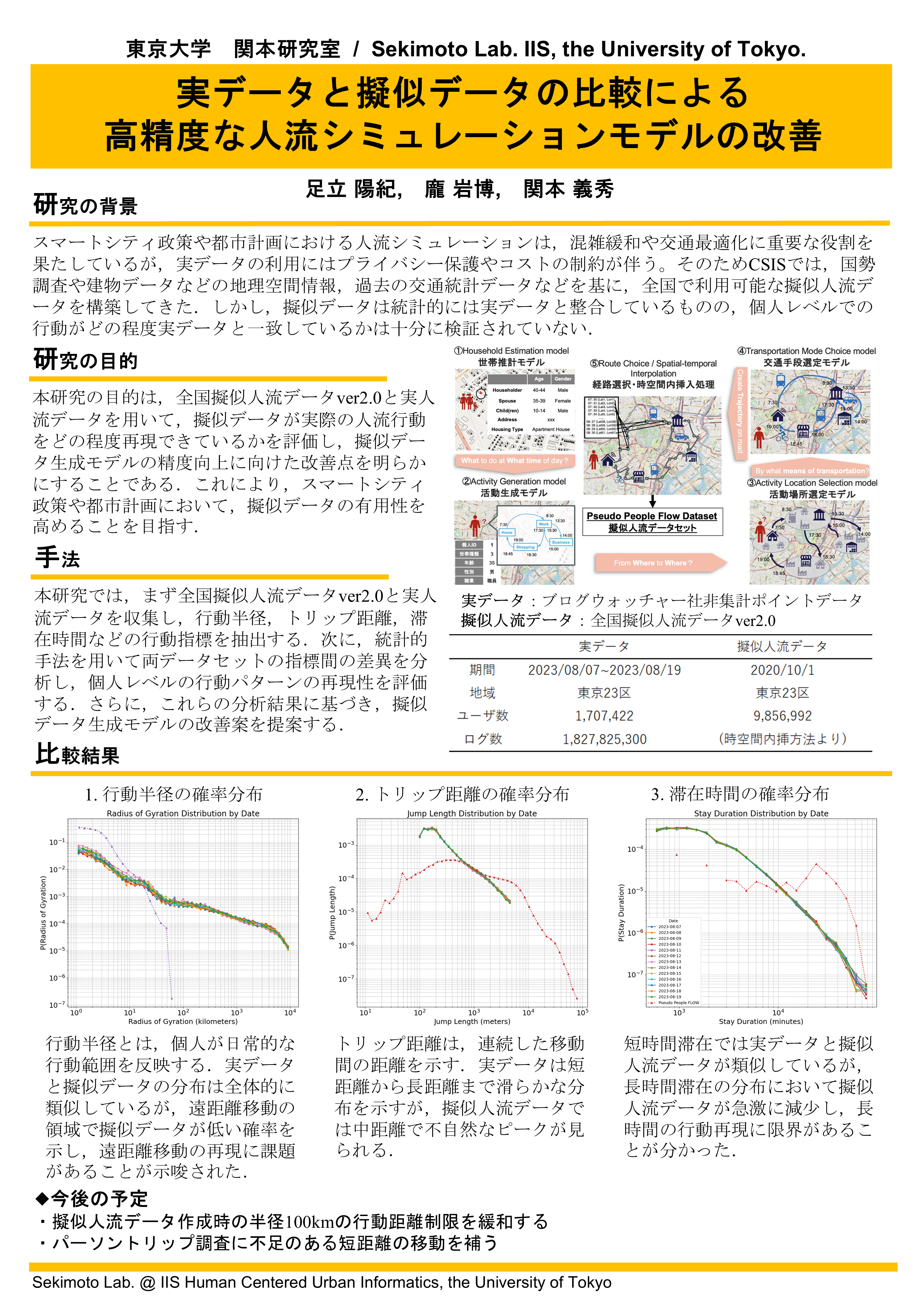
5: Improvement of High Accuracy People Flow Simulation by Comparing Real Data and Synthetic Data
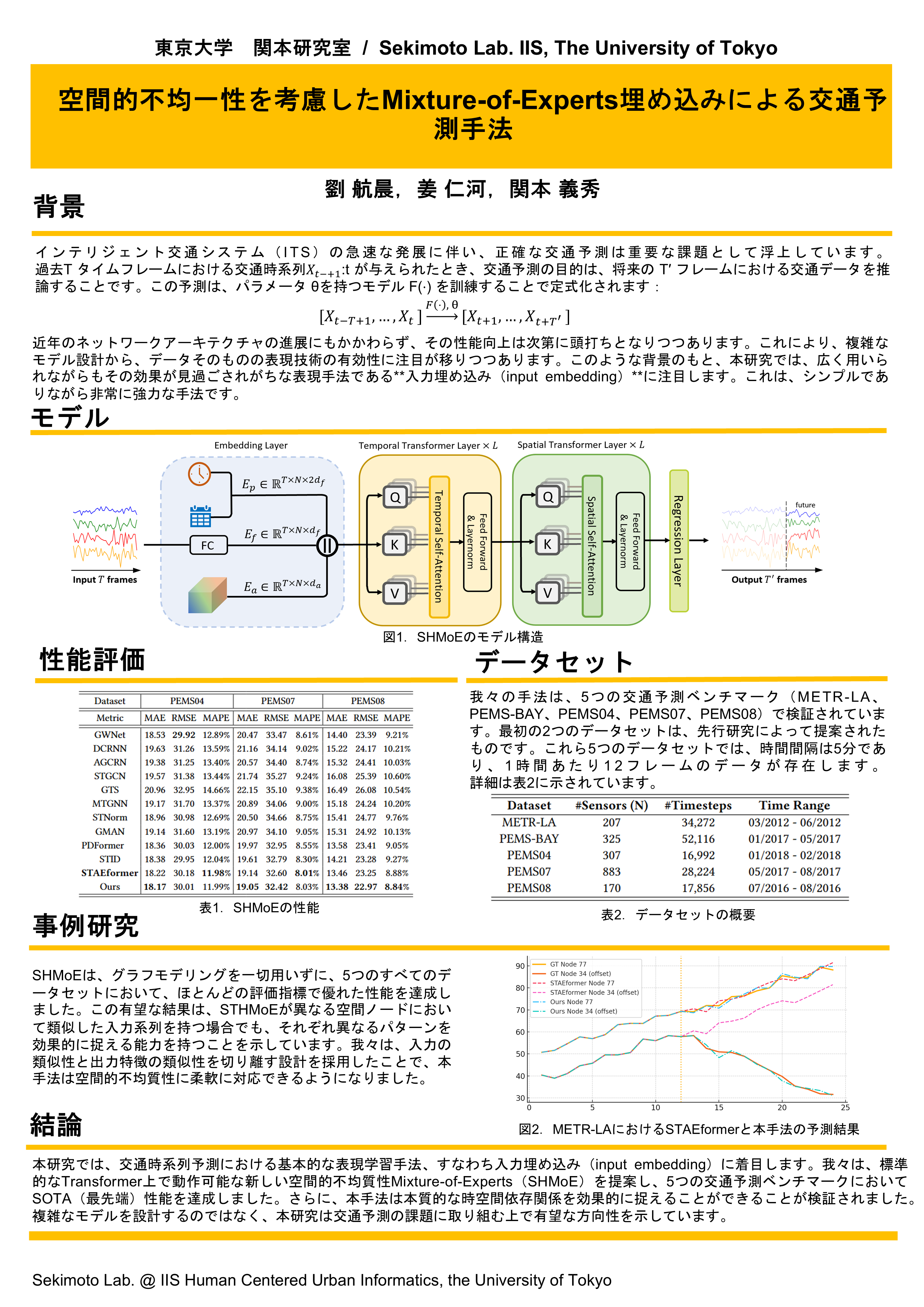
6: Spatio Heterogeneity Mixture-of-Experts Embedding for Traffic Forecasting
DCBC: Digital City & Behavior Changes
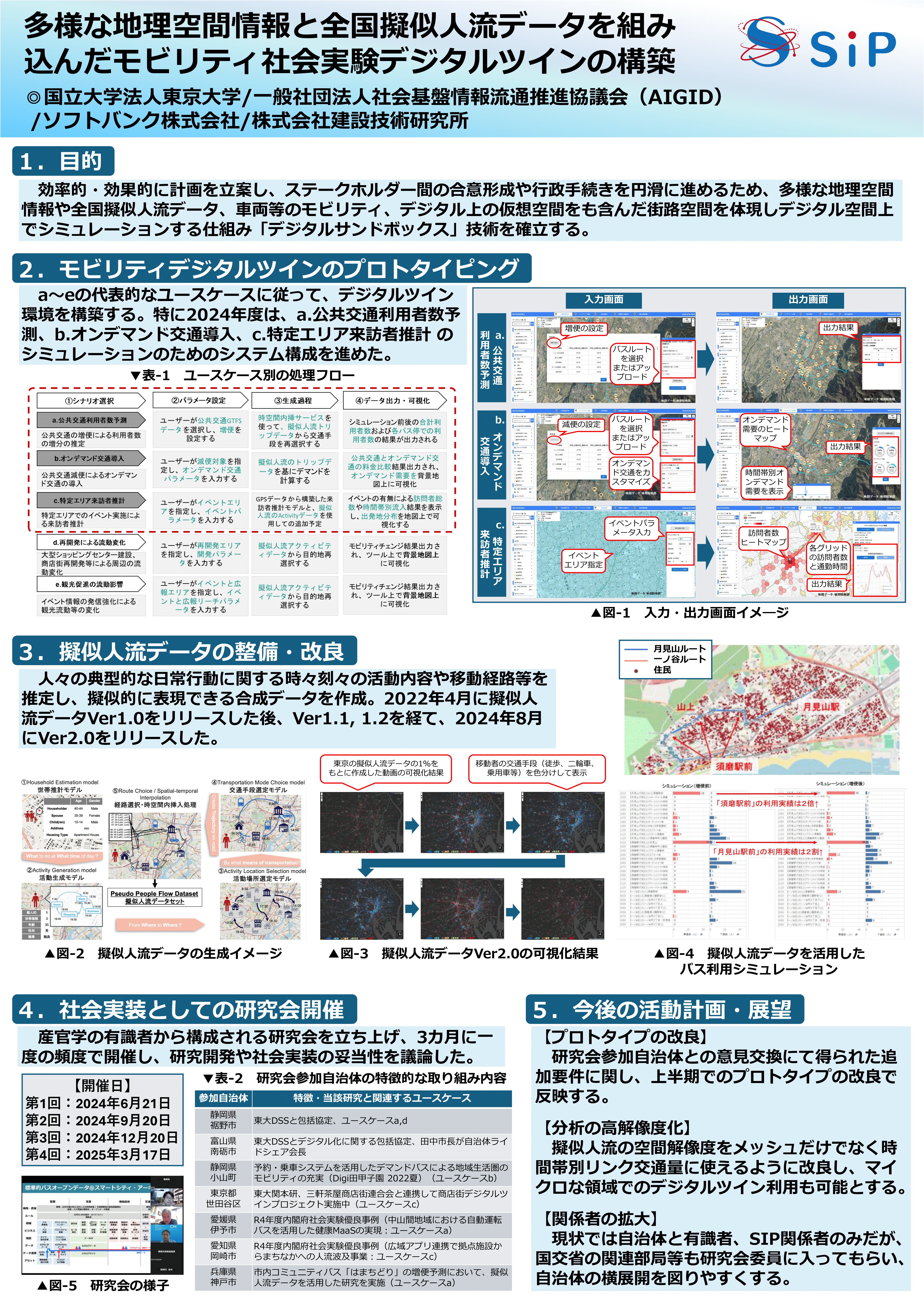
1: Construction of a digital twin for social mobility experiments incorporating diverse geospatial information and nationwide pseudo-human flow data
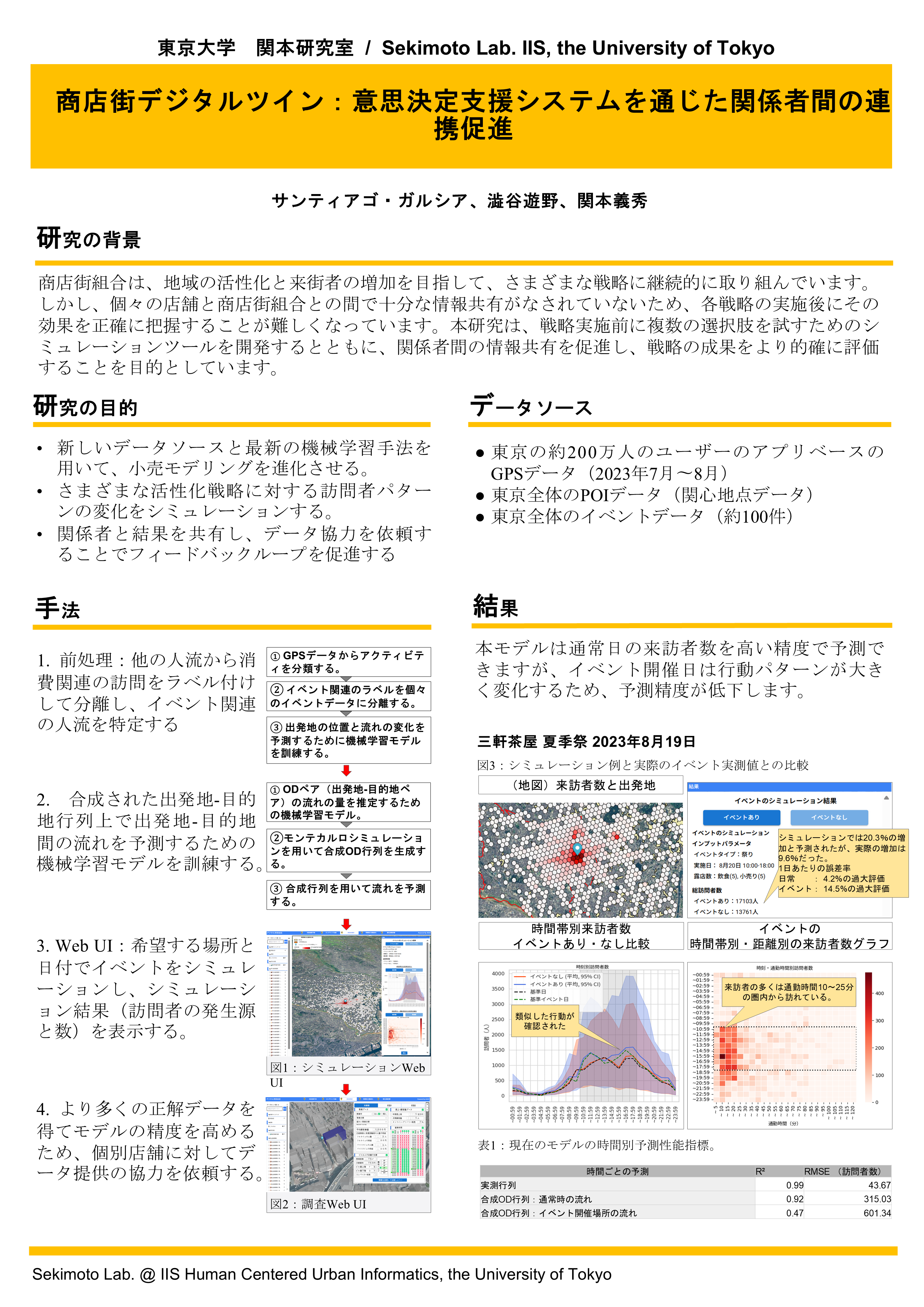
2: Shotengai Digital Twin: promoting stakeholder collaboration through decision support systems
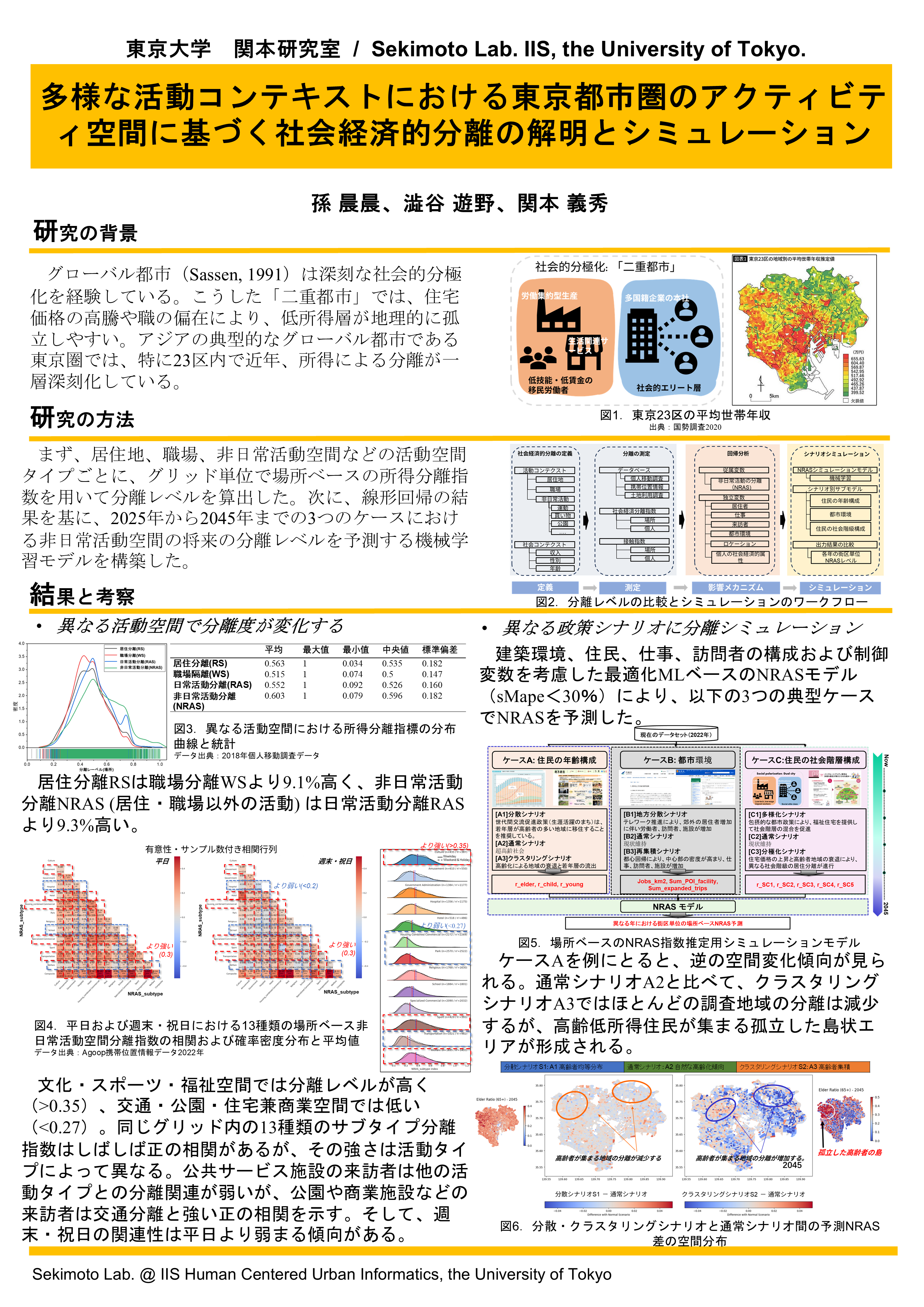
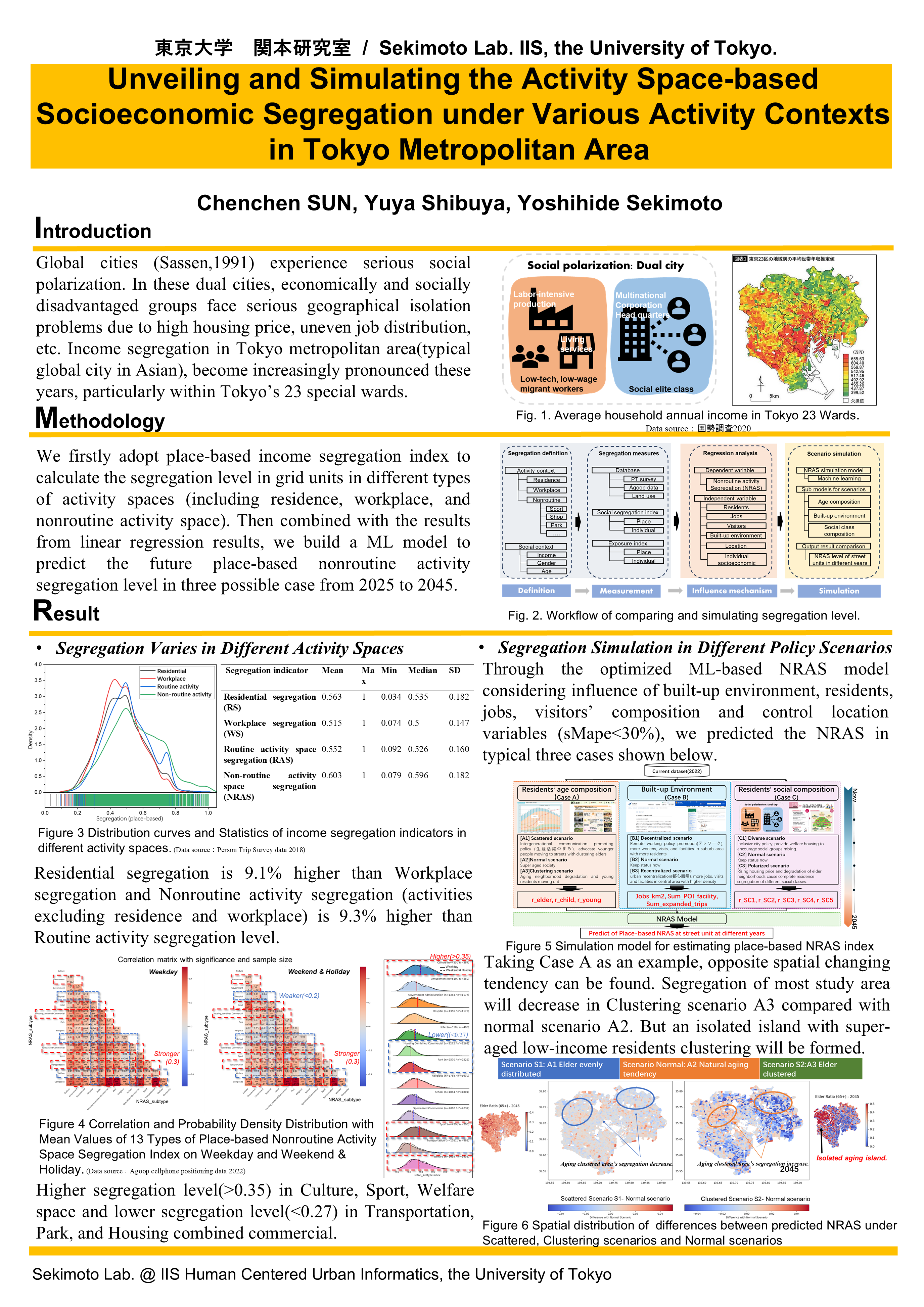
3: Unveiling and Simulating the Activity Space-based Socioeconomic Segregation under Various Activity Contexts in Tokyo Metropolitan Area
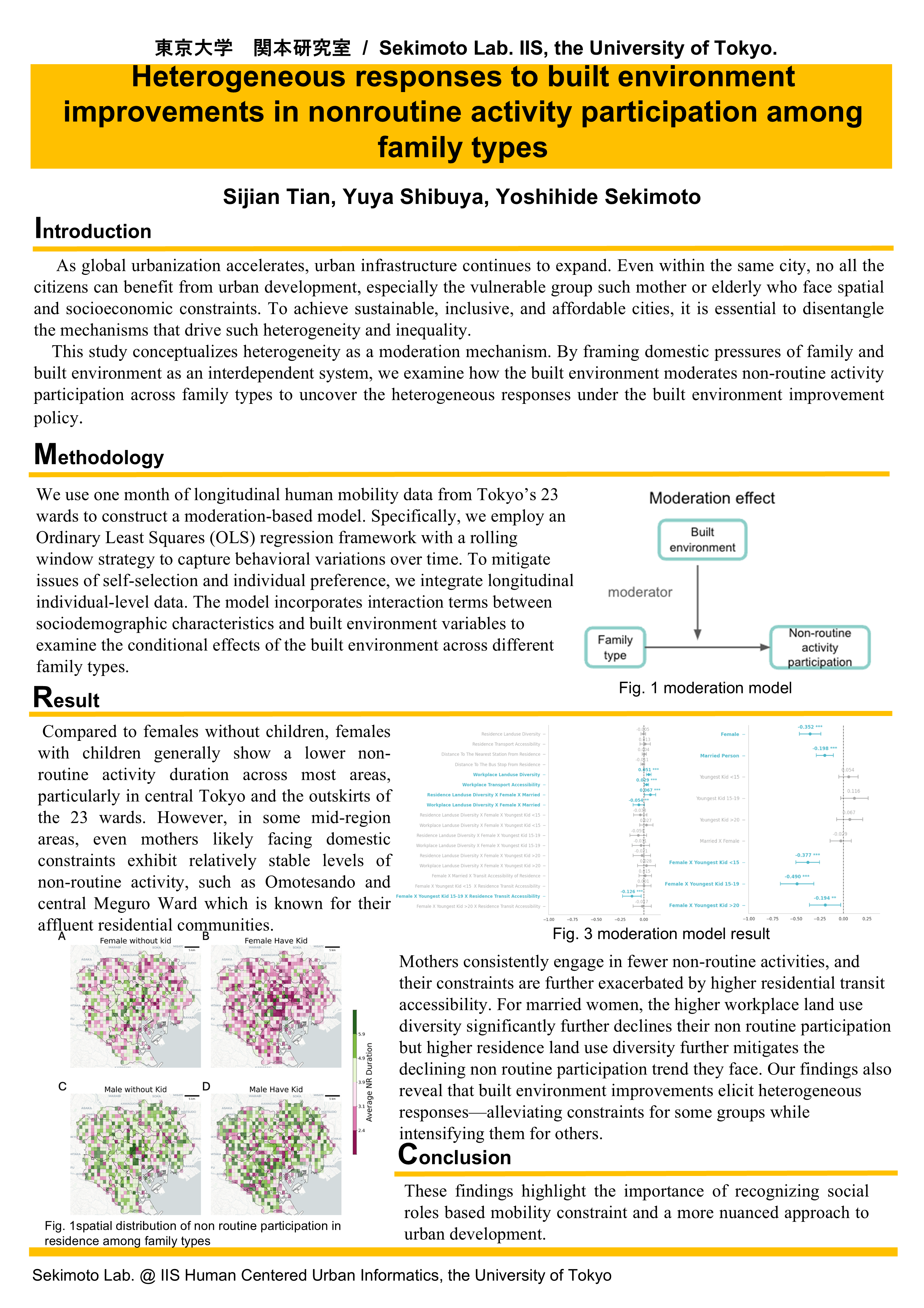
4: Heterogeneous responses to built environment improvements in nonroutine activity participation among family types

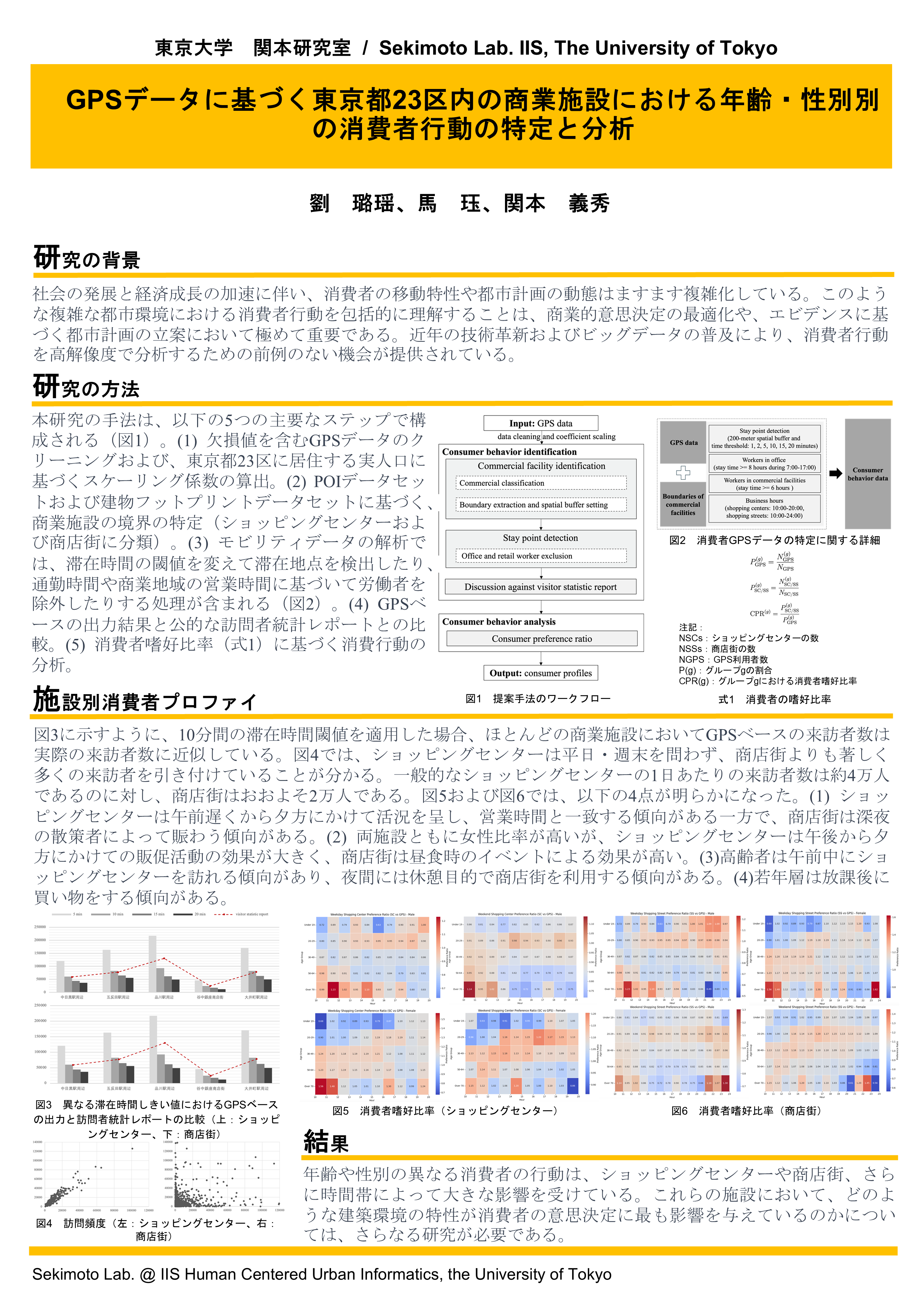
5: Identification and Analysis of Consumer Behaviors by Age and Gender within Commercial Facilities in the 23 wards of Tokyo from GPS Data

MLI: Machine Learning Based Image Processing
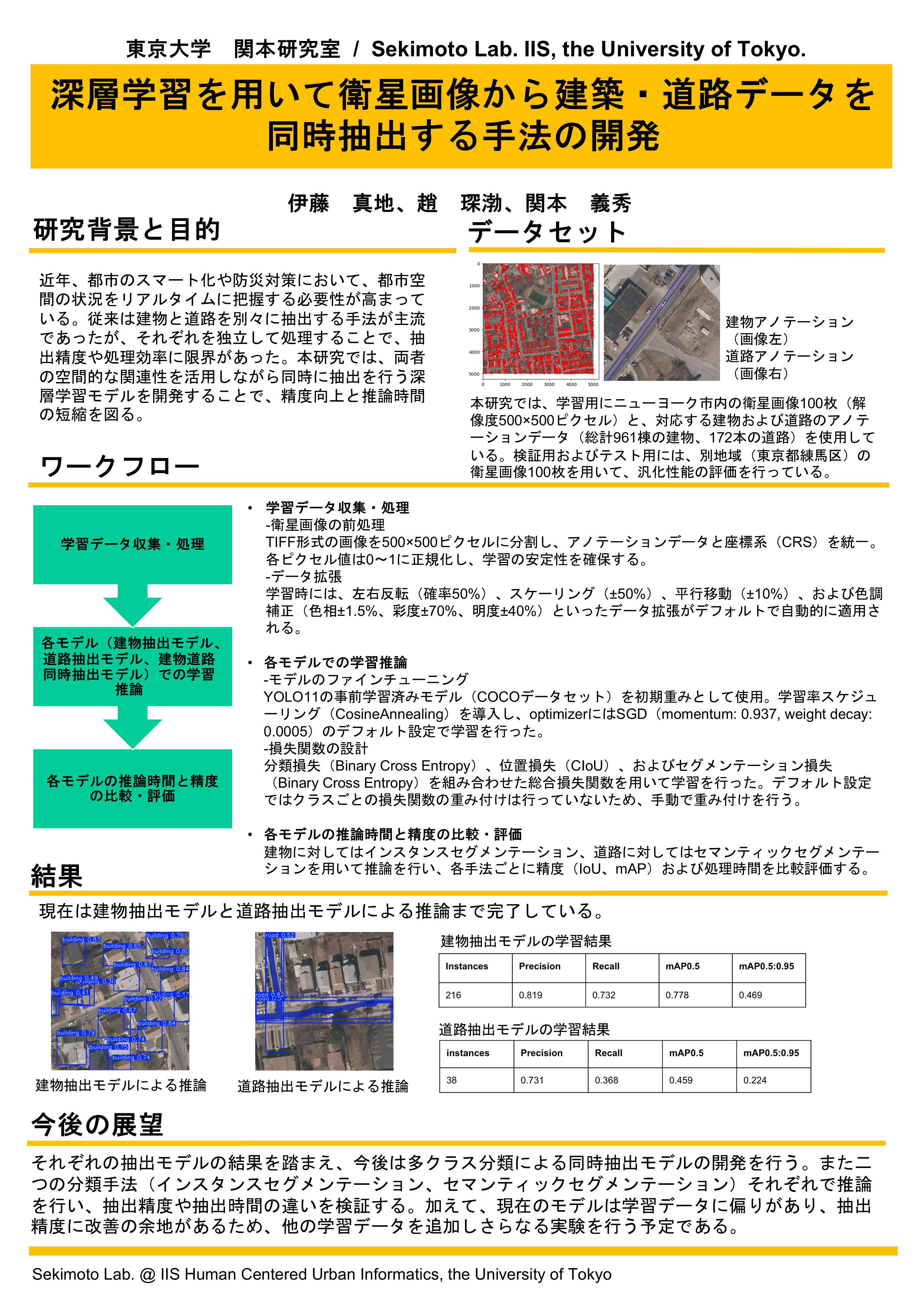
]1: Developing a method for simultaneous extraction of building and road data from satellite imagery using deep learning